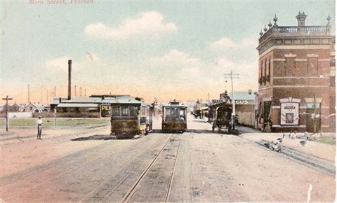
High Street, Northcote
From Separation or Dennis Streets to Dundas Street was formally known as Plenty Road.
High Street, along with Hoddle Street, Punt Road and Barkly Street together form the 'Hoddle Line'. This was the north-south axis drawn by Robert Hoddle when surveying Greater Melbourne and Victoria. It was exactly two miles east of Batman's Hill. All roads were measured from this line.
Carroll, Brian & Rule, Ian (1985). Preston: an Illustrated History. Preston: City of Preston.
City of Northcote (1933). Northcote Jubilee celebrations 1883 – 1933 : souvenir & official program. Northcote: Author.
City of Northcote Valuers Department. (1994). Street Name Changes, Northcote: City of Northcote.
City of Preston (1935). Preston Jubilee celebrations: 1885 – 1935. Preston: Author.
Forster, Harley W. (1968). Preston Lands and People. Melbourne: Cheshire.
Harcourt, Rex (1994). Discovering Northcote. Unpublished notes.
Lemon, Andrew (1983). The Northcote Side of the River. North Melbourne: Hargreen.
Northcote Historical & Conservation Society. (1988). Northcote: Glimpses of Our Past. Northcote, Vic: Author.
Sands and McDougall’s Melbourne and Suburban Directory 1864- 1974. [Microfiche]. (1974). Melbourne, Australia: Sands & McDougall.
HighStreet2.pdf(PDF, 19KB)